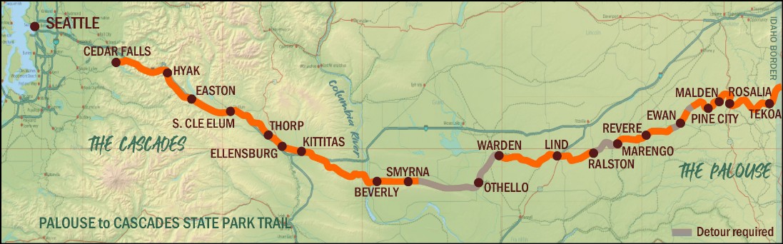

WESTERN WASHINGTON
The 110 mile long western Washington section of the Palouse to Cascades Trail (from the western slopes of the Cascade Mountains to the Columbia River) is owned and operated by Washington State Parks as the Palouse to Cascades State Park Trail, (previously the Iron Horse State Park Trail/John Wayne Pioneer Trail) and does not require a permit for day use. However, as with all Washington State Parks, a Discover Pass is required to park at the trailheads. The 22 miles of the PTCT just west of the Columbia River through the Army's Yakima Training Center, is subject to YTC rules although administrated by WA State Parks. A self-administered sign-in permit is required at the Yakima Training Center trailheads.
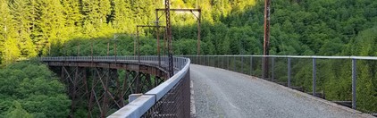
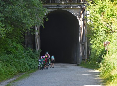
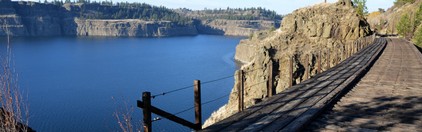
Starting in the west at Cedar Falls (on Rattlesnake Lake near North Bend) the trail climbs east through evergreen forests, crossing high trestles, and traveling under the summit of Snoqualmie Pass through the 2.3 mile long Snoqualmie Tunnel (the longest trail tunnel in the country). Exiting the tunnel east of the Cascades at Hyak, the trail descends gradually, skirting the eastern shore of Lake Keechelus, then following the Yakima River through the Upper Yakima River Canyon, traversing the farmland of the Kittitas Valley and finally, crossing the arid shrub-steppe habitat of the Army's Yakima Training Center to the Columbia River.
Palouse to Cascades State Park Trail includes numerous trailheads with good signage, 5 primitive hiker/biker campsites (See Route Map for locations. $12.00 camp site fee is required - collection box at sites), and a generally well-maintained crushed gravel surface, with the exception of the sandy section through the Training Center. There are two additional hiker/biker campsites at Lake Easton State Park, which the trail passes through.More information can be obtained through Washington State Parks:
West of Hyak call the Cascade Foothills Area office at (425) 455-7010.Hyak to the Columbia River call the Lake Easton office at (509) 656-2230
NOTE:
The 2 mile-long Snoqualmie tunnel (east portal at Hyak, near Snoqualmie Pass summit) is closed during winter months, generally from November 1 until May. Check with State Parks about status.
EASTERN WASHINGTON
The eastern Washington section (from east of the Columbia River at Beverly to the Idaho border) of the Palouse to Cascades Trail is largely undeveloped. Click here for information from State Parks on the trail through eastern Washington. Some sections are closed, private, or gated, and may require detours.ALL of the PTCT east of the Columbia River requires registration with State Parks for use. A Discover Pass does not take the place of registration. Registration is FREE, good for a year, and used by some legislators to measure the number of people using the trail. You are only required to show your registration to State Park staff.Please make sure you are counted as a trail user by registering!
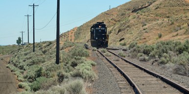
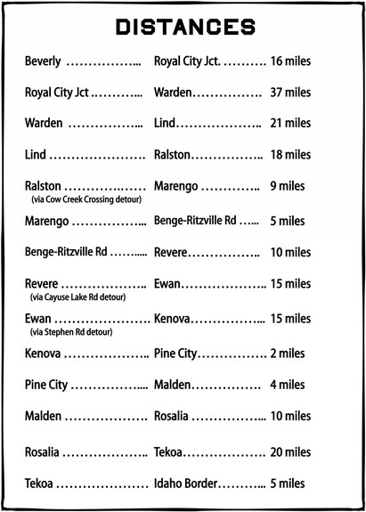
The 39 miles from Royal City Junction to the city of Warden still has active rail, requiring a detour on local light-traffic roads.Active rail at Royal City Junction
The 105 miles from Lind to the Idaho border are owned by Washington State Parks (with the exception of a few short private property gaps totaling approximately 4 miles). This section of trail traverses the rangeland and agricultural expanse of the Columbia Plateau, the Ice Age flood-sculpted channeled scablands, and the rolling wheatfields of the Palouse.
There are long distances between services and water in the towns along the way, and the trail surface is currently unmaintained with sections of compact sand, coarse gravel, and railroad ballast.Washington State Parks is working to develop the trail from the eastern terminus at the Idaho border westward, but continued development depends upon funding.
NOTE: The Palouse to Cascades Trail is unpaved with variable surface conditions. In general, better surfaces are found west of the Columbia River, with areas of coarser gravel and sand east of the Columbia River. Washington State Parks is working to improve the trail surface.
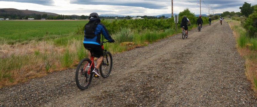
Typical surface between Hyak and Ellensburg west of the Columbia River
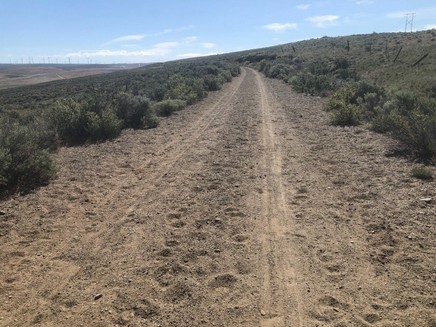
Sandy surface between Renslow and Boylston just west of the Columbia River,
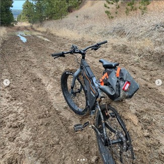
and a few wet/muddy spots in eastern Washington closer to the Idaho border.